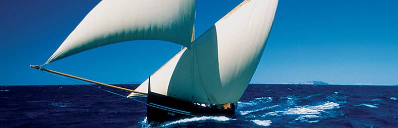
Explore Croatia’s coastline from the deck of a boat.
The Adriatic is one of Europe’s easiest places to try sailing, with sheltered waters, short distances between islands and well-equipped marinas. Most visitors begin their trip from Dubrovnik, or from other major sailing hubs such as Zadar and Split. From here, you can reach quiet bays, swimming spots, small island villages and historic ports within a short time on the water.
Croatia offers three main ways to go sailing, depending on your experience and how involved you want to be. Bareboat charters are suitable for qualified sailors who want full control, skippered boats work well for travellers who prefer a professional to handle the route and manoeuvres, and fully crewed options provide the most comfort for families or groups. For availability, options and practical information, visit our Yacht charter and boat rental in Dubrovnik page.
Quick overview of sailing in Dubrovnik
Sailing from Dubrovnik is suitable for beginners, casual travellers and experienced sailors. The waters around the city are generally calm, distances between islands are short, and there are many sheltered bays for swimming or taking breaks. Most organised trips stay close to the coast, making them easy for first-time visitors.
- Short trips include half-day, sunset and full-day tours to the Elaphiti Islands.
- Multi-day routes often combine Mljet, Korčula and the Pelješac coastline.
- The main season runs from late April to October, with the warmest conditions from June to September.
- Bareboat, skippered and fully crewed charters are available, depending on your experience.
- Starting points include the Old Town area and Gruž harbour.
Adventure Sailing 3-Night Trip from Dubrovnik on the Huck Finn Catamaran
Embark on a 3-night sailing adventure from Dubrovnik and uncover the hidden bays and islands.
Explore lesser-known gems, including the charming town of Ston with its medieval walls and renowned oysters, the ancient villages of the Elaphiti Islands, and the lush landscapes of Mljet Island National Park. Daily activities such as kayaking, hiking, and cave exploration are included. With a small-group setting, personalized attention from the crew ensures an enriching journey filled with insights into the history and culture of each destination. Join us aboard the Huck Finn Catamaran for an unforgettable adventure sailing experience!
Why sail from Dubrovnik
Dubrovnik is one of the best starting points for sailing in Croatia thanks to its sheltered island chain, reliable weather and well-organised marinas. The coast is easy to navigate, even for beginners, and most destinations are reached within a short distance, making day trips and relaxed multi-day routes straightforward.
- The Elaphiti Islands, including Koločep, Lopud and Šipan, sit just northwest of the city and offer quiet bays, beaches and small villages.
- The water around Dubrovnik is usually calm, especially in summer, which makes it suitable for first-time sailors.
- Clear visibility and short sailing legs mean less time travelling and more time swimming or exploring.
- ACI Marina Dubrovnik provides full services for charters and private boats.
- Historic views of the Old Town and its coastline create a memorable start and finish to any trip.
Types of sailing experiences from Dubrovnik
Visitors can choose between several sailing options depending on their experience, comfort level and how involved they want to be during the trip. If you want to understand how these options work across Croatia in general, you can also see a clear overview on Boat rental and sailing options in Croatia. All three options operate from the Dubrovnik area and are available for short outings or longer coastal routes.
Bareboat charter
Suitable for experienced sailors with a valid licence. You are responsible for navigation, safety and planning the route. This option offers full independence and works well for those familiar with the Adriatic or comfortable handling a yacht on their own.
Skippered charter
Ideal for travellers without sailing experience or for groups that prefer a relaxed approach. A professional skipper manages the boat, handles docking and monitors the weather, while you choose how active you want to be during the trip.
Fully crewed charter
Best for families, special occasions or anyone looking for maximum comfort. A full crew takes care of navigation, meals and onboard service, allowing guests to focus entirely on swimming, sightseeing and enjoying the route.
Short sailing trips and day tours from Dubrovnik
Short sailing outings are the most popular choice for visitors who want to spend a few hours on the water without committing to a full-day or multi-day trip. These experiences usually stay close to Dubrovnik’s coastline and the nearby Elaphiti Islands, making them suitable for families, beginners and travellers with limited time.
Half-day and sunset sailing
Half-day trips typically explore the waters around Lokrum and the Dubrovnik coastline, with time for swimming in sheltered bays. Sunset tours follow a similar route but time the journey to include the evening light over the Old Town walls, often considered one of Dubrovnik’s best views from the sea.
Full-day Elaphiti Islands sailing
Full-day tours head to the Elaphiti Islands, combining island visits with swimming and snorkelling stops. Most routes include Koločep and Lopud, with breaks in quiet coves or sandy beaches. Depending on the operator, there may also be free time for lunch in a local restaurant or a picnic on board.
Multi-day adventure sailing trips
Several operators offer 2-3 day adventure-style sailing experiences. These trips are relaxed and suitable for all ages, focusing on swimming, kayaking, cycling or light hiking around the islands. Overnight stays are usually in small island harbours such as Šipan or in sheltered bays, with simple onboard accommodation.
Adventure Sailing 3-Night Trip from Dubrovnik on the Huck Finn Catamaran
A full-day sailing trip around the Elaphiti Islands is one of the most enjoyable ways to experience Dubrovnik’s coastline.
This small-group outing gives you time to swim in quiet bays, visit island villages and enjoy the views from the deck while the skipper handles the route and the sailing. With only a handful of guests on board, the day stays relaxed and uncrowded, and the boat moves at an easy pace between Koločep, Lopud and Šipan.
There’s plenty of time to stop for swimming, snorkelling or simply relaxing in the shade on deck. Depending on conditions, you may visit sandy Šunj Beach on Lopud, quiet coves around Koločep, or one of Šipan’s sheltered harbours.
Popular sailing routes and destinations
Most routes from Dubrovnik follow short, sheltered passages between nearby islands, making the area suitable for both beginners and relaxed holiday sailing. Sailing distances are modest, and many stops can be reached within an hour or two, which is why day trips and slow-paced multi-day itineraries are so common in this region.
Elaphiti Islands from Dubrovnik
The closest sailing area to the city is the Elaphiti archipelago, made up of Koločep, Lopud and Šipan. These islands offer calm anchorages, sandy or pebble beaches and small ports suitable for short or full-day sailing trips.
- Dubrovnik to Koločep: usually around 30-45 minutes of sailing.
- Dubrovnik to Lopud: roughly 45 minutes to 1 hour.
- Dubrovnik to Šipan: around 1.5 to 2 hours, depending on wind and route.
South Dalmatia: Mljet, Korčula and Pelješac
Longer trips from Dubrovnik often combine the national park on Mljet, the historic town of Korčula, and quiet bays along the Pelješac coastline. These routes are popular for 3-7 day charters, offering a mix of cultural sights, swimming stops and relaxed coastal sailing.
- Dubrovnik to Mljet (Pomena/Polace area): typically 2 to 3 hours of sailing.
- Dubrovnik to Pelješac bays: often 2 to 3 hours depending on the specific inlet.
- Mljet to Korčula Town: usually 1.5 to 2.5 hours via the channel.
Longer routes up the coast
Sailors planning a one-way or extended holiday sometimes head north toward central Dalmatia. Typical stops include the larger islands around Hvar and Vis, or national park areas further north. These routes require more planning and may include longer open-water passages, but they offer a wider variety of landscapes and coastal towns.
- Dubrovnik to Korčula (direct route): often 4 to 6 hours depending on conditions.
- Korčula to Hvar: typically 4 to 5 hours of sailing along the island chain.
- Hvar to Vis: around 2 to 3 hours in normal summer winds.
Summary of typical sailing times from Dubrovnik
| Destination | Approx. sailing time | Notes |
|---|---|---|
| Koločep | 30-45 minutes | Closest island; calm, sheltered passages ideal for short trips. |
| Lopud | 45 minutes-1 hour | Popular day-trip stop with beaches and small harbours. |
| Šipan | 1.5-2 hours | Largest Elaphiti island; good anchorages and quiet bays. |
| Mljet (Pomena/Polace) | 2-3 hours | National park area with lagoons and sheltered moorings. |
| Pelješac coast | 2-3 hours | Many small coves; good for relaxed overnight stops. |
| Korčula Town | 4-6 hours (direct) | Historic old town; often combined with Mljet on charters. |
| Korčula to Hvar | 4-5 hours | Common mid-route leg on longer trips north. |
| Hvar to Vis | 2-3 hours | Straightforward open-water passage in settled summer weather. |
When to go sailing in Dubrovnik
The sailing season in Dubrovnik runs from late April to October, with the most stable weather and warmest sea conditions found from June to September. For a clearer idea of temperatures, sunshine hours and seasonal changes, see our weather in Dubrovnik page. Early and late season months offer quieter anchorages and milder temperatures, while the peak summer period brings longer days and calm seas.
Sailing seasons and crowd levels
- April-May: Cooler water but pleasant weather on land. Good for those wanting quieter marinas and easier availability.
- June: Reliable weather begins, and sea temperatures rise, making it a good month for swimming and day trips.
- July-August: Peak season with warm seas, light winds and busy islands. Best conditions for beginners and families.
- September-October: Stable weather continues with fewer crowds. Sea remains warm, especially in September.
Typical winds and sea conditions
Most sailing days around Dubrovnik are calm, especially during summer. The region has several characteristic winds:
- Maestral: A gentle, regular northwesterly wind that brings comfortable sailing during summer afternoons.
- Bura: A strong, dry wind from the northeast. Less common in summer but can create rougher sea conditions when it appears.
What to pack for a sailing trip
- Light clothing, swimwear and sun protection (hat, sunglasses, reef-safe sunscreen).
- A light jacket or windbreaker, especially for evening sails.
- Non-slip footwear suitable for boat decks.
- A dry bag for phones, documents and valuables.
- Reusable water bottle and basic snacks for longer outings.
Marinas, moorings and practical logistics
Most sailing trips in the Dubrovnik area start from a few well-known points around the city. Whether you are joining a day tour or beginning a longer charter, it helps to know where boats depart, what facilities are available and how to plan basic logistics such as parking or provisioning.
Starting points near Dubrovnik
- ACI Marina Dubrovnik (Komolac): The main base for yacht charters. Located up the Ombla River, it offers calm conditions, space for larger boats and full technical services.
- Gruž harbour: The city’s main port area, used by many operators for day trips and private tours. It is easy to reach by bus or taxi and connects with regional and international ferries - see more details on the Dubrovnik ferry port page.
- Old Town and Ploče area: Smaller sailing and boat trips sometimes depart from piers outside the city walls, especially for half-day or sunset routes.
How to get to ACI Marina Dubrovnik
- By local bus: Several city bus lines run between the Old Town, Gruž and the Ombla River area. For routes, timetables and tickets, see our Dubrovnik by bus guide.
- By taxi or transfer: Taxis and pre-booked transfers can drop you directly at the marina entrance, which is convenient if you are travelling with luggage.
- By car: Drivers coming from the city or the main road can follow signs towards Komolac and ACI Marina Dubrovnik. Traffic is usually lighter than in the centre, but it is still wise to allow extra time in peak season.
Facilities and services for sailors
- Fuel, water and electricity are available at ACI Marina Dubrovnik, with reliable service throughout the season.
- Showers, restrooms and laundry facilities are located within the marina complex.
- Small supermarkets and shops nearby make it easy to stock up on food, water and basic supplies before starting a trip.
- Parking is available at the marina, and travellers using Gruž as a starting point can also look at dedicated options such as Gruž port parking. Spaces can fill up in peak months, so arriving earlier in the day is recommended.
Mooring, anchoring and overnight stays
- Most islands around Dubrovnik offer sheltered bays suitable for short stops or swimming breaks.
- The Elaphiti Islands have several small harbours where boats can moor for lunch or an overnight stay.
- Anchoring is allowed in many areas, but visitors should avoid marked protected zones or areas with underwater vegetation.
- Overnight conditions are generally calm during summer, making the region friendly for first-time charter guests.
Charter, licences and booking tips
Before booking a sailing trip from Dubrovnik, it is important to understand basic licence rules, what is included in a charter price and how far in advance to reserve. Requirements are straightforward, but they differ depending on whether you plan to skipper the boat yourself or hire a professional skipper and crew.
Licence requirements and experience levels
If you want to charter a bareboat and act as skipper, you will need a valid boating licence recognised by the Croatian authorities, as well as a short-range radio (VHF) certificate. Many visitors use an ICC (International Certificate of Competence) or a national coastal skipper licence. Charter companies will ask to see original documents before handover and may refuse a bareboat charter if the skipper’s experience is limited or unclear.
- No licence is required for guests booking a skippered or fully crewed charter - the professional skipper is responsible for navigation and safety.
- Even with a licence, some travellers choose a skipper for their first Adriatic trip to reduce stress and learn local conditions.
- It is wise to be honest about your experience level when booking, especially if you have not sailed in the region before.
How to choose a boat or tour
The right option depends on group size, budget and how you prefer to spend time on board. When comparing offers, look at more than just the headline price.
- Group size and layout: Check the number of cabins, berths and bathrooms, and whether separate crew cabins are available on larger boats.
- Type of boat: Classic monohull yachts are usually cheaper and more “traditional”; catamarans offer more space and stability, which can be better for families.
- Trip style: Decide whether you want a relaxed swimming and sunbathing trip, a more active route with hiking or cycling, or a one-way journey covering longer distances.
- Departure point: Confirm whether the boat departs from ACI Marina Dubrovnik, Gruž or another nearby base to plan your arrival and supplies.
Typical costs and how to save
Prices vary by season, boat size and level of service. High season (July and August) is the most expensive period, while late spring and early autumn are often more affordable. Day trips are usually priced per boat or per person, and week-long charters are priced per week.
- Booking outside the peak summer weeks can significantly reduce charter and tour prices.
- Sharing a larger boat between several couples or families helps spread costs.
- Always check what is included in the price (skipper fee, fuel, final cleaning, port fees and tourist taxes) and which extras are paid on arrival.
- Read booking conditions carefully, especially cancellation rules and security deposit requirements.
Island hopping by ferry vs private sailing
Many visitors combine Dubrovnik’s public ferries with private sailing trips. Both options are easy to use, but they offer different experiences. Ferries are practical for moving between islands on a fixed schedule, while sailing allows more flexibility, swimming stops and access to smaller bays that ferries do not serve. For an overview of routes and operators serving the region, see our Dubrovnik ferries guide.
When ferries make more sense
- You want a quick and affordable way to reach islands such as Lopud, Šipan or Mljet.
- You prefer fixed timetables and straightforward point-to-point travel.
- You are carrying luggage and staying overnight on an island.
- You plan to visit several islands independently and are comfortable organising your own schedule.
- Departures from Gruž are simple to use - see the Dubrovnik ferry port page for details.
When a sailing trip is the better option
- You want swimming stops, hidden coves and quieter bays that ferries cannot access.
- Your group prefers a relaxed, flexible day without fixed departure and return times.
- You want to combine several islands in a single outing without waiting for connections.
- You enjoy being on the water and seeing Dubrovnik’s coastline, cliffs and Old Town views from offshore.
- You want the option to follow the best weather and sea conditions on the day.
For many travellers, a combination of both works well, ferries for simple island-to-island travel, and a private sailing day for exploring the bays and coves that make Dubrovnik’s coastline unique.
Dubrovnik Private Romantic Sunset Sailing
A sunset sail along Dubrovnik’s coastline offers some of the most memorable views of the city, especially as the light softens over the Old Town walls and Lokrum Island.
The skipper follows an easy route chosen for calm waters and good visibility, making it suitable for couples, friends or anyone wanting a slower, more scenic end to the day.
As the sun begins to set, the boat anchors in a sheltered spot so you can relax, take photos or enjoy the changing colours over the Adriatic. The pace is unhurried, and the crew focuses on creating a smooth, enjoyable experience rather than rushing between stops
Safety, regulations and marine environment
Sailing around Dubrovnik is generally safe, especially in summer when the sea is calm and visibility is good. Still, it is important to follow basic safety practices and be aware of local regulations. Weather conditions can change quickly, so always check the latest forecast before departure - our weather in Dubrovnik page is a useful starting point.
Basic safety tips on the water
- Wear or keep lifejackets within easy reach, especially for children.
- Avoid standing on wet or unstable surfaces when the boat is under way.
- Drink plenty of water and protect yourself from the sun with hats, sunglasses and sunscreen.
- Listen to the skipper’s instructions, particularly when docking or manoeuvring.
- Plan swimming stops only in calm and clearly marked areas away from other vessels.
Official nautical information and apps
Croatia provides several reliable sources for maritime safety and weather updates:
- National weather forecasts: Check official marine bulletins before any trip, especially outside peak summer.
- nIS (Nautical Information Service): A Croatian mobile app offering alerts, safety notices, maps and emergency contact details.
- Harbourmaster’s guidance: Local harbour offices can advise on conditions, mooring rules and restricted zones.
Respecting the Adriatic and marine life
- Avoid anchoring in protected areas or on seagrass meadows, which are vital for marine ecosystems.
- Dispose of waste responsibly and never throw rubbish into the sea.
- Keep a respectful distance from dolphins or other wildlife.
- Use eco-friendly sunscreens to reduce damage to marine habitats.
- Follow all marked zones and signage around national parks and swimming areas.
Adriatic Sea facts for sailors
The Adriatic around Dubrovnik is known for clear water, mild tides and generally calm summer conditions. These characteristics make the region suitable for beginners and relaxed coastal sailing. Below are a few simple points that help visitors understand what to expect on the water.
Depths and underwater landscape
- Coastal areas and island passages are relatively shallow, making navigation straightforward.
- Deeper water appears farther offshore, but most day trips stay within sheltered zones.
- Rocky seabeds are common, so care is needed when anchoring near shore.
Sea temperature by season
- May–June: Water gradually warms, comfortable for longer swims later in June.
- July–August: Warmest period with excellent swimming conditions.
- September–October: Sea stays warm into early autumn, cooling slowly by late October.
Currents, tides and waves
- Tides in the Adriatic are mild, usually noticeable only in harbours and narrow areas.
- Currents are weak near the Dubrovnik coast and rarely affect small leisure boats.
- Summer waves are generally low, with calmer conditions in the morning and early afternoon.
- Stronger winds such as Bura or Jugo can create choppier seas, which is why checking the forecast remains important.
Key Adriatic Sea facts for sailors:
- Typical summer sea temperature: 24–27 °C
- Winter sea temperature: 7–12 °C
- Common wave height in summer: 0.5–1.5 metres
- Maximum depth in the South Adriatic basin: around 1,200–1,300 metres
- Average coastal current speed: about 0.5 knots
- Typical tidal range near Dubrovnik: 20–40 centimetres
Adriatic Sea facts for sailors
The Adriatic around Dubrovnik is known for its clear water, mild tides and mostly calm summer conditions, which is why it is so well suited for relaxed coastal sailing. Below is a simplified overview based on general oceanographic and hydrographic characteristics of the Croatian Adriatic.
Depths and underwater landscape
The Croatian Adriatic becomes progressively deeper from north to south. In the northern part, especially around Istria, depths often stay below 50 metres. Further offshore lies a long, narrow depression known as Jabučka kotlina, where depths reach roughly 200–250 metres. South of this area, the seabed rises again around the Palagruža ridge (about 100–150 metres), before dropping into the South Adriatic basin, where the maximum recorded depth is around 1,200–1,300 metres. Around Dubrovnik and the Elaphiti Islands, leisure boats mostly travel in much shalower coastal waters, with deeper channels between islands and rocky seabeds close to shore.
Sea temperature through the year
Sea temperatures change significantly by season. In winter, surface temperatures in the Adriatic can fall to around 7–12 °C. During spring the sea warms quickly, often reaching 15–18 °C by late spring. In summer, surface temperatures commonly rise to about 24–27 °C, making conditions very comfortable for swimming. Swimmers may notice thermoclines – layers of different temperature – especially in summer. The first thermocline is often found at a depth of roughly 3–5 metres, with additional layers around 10–20 metres. Below about 30 metres, temperatures tend to stay relatively stable throughout the year.
Sea currents
Sea currents in the Adriatic are influenced by wind, differences in pressure, temperature and salinity. Near the Croatian coast, average current speeds are generally low, often around 0.5 knots or less, although in certain narrow channels or during strong winds they can temporarily reach several knots. For most leisure sailing around Dubrovnik, these currents are not a major factor, but skippers still pay attention to them when planning routes in more exposed areas.
Sea salinity
Salinity in the Adriatic is relatively high. On average, values are around 38 ‰ (grams of salt per kilogram of seawater). In the northern Adriatic, salinity can be slightly lower due to river inflow, while the central and southern parts – including the Dubrovnik area – typically show higher and more stable values. For visitors, this means clear, buoyant water that is pleasant for swimming and snorkelling.
Tides
Tidal ranges in the Adriatic are modest compared with many other seas. In the southern Adriatic, including the Dubrovnik area, the difference between high and low tide is usually on the order of 20–40 centimetres. Further north, in places such as Istria and the Gulf of Trieste, tidal ranges can reach around 1 metre. Strong and persistent south-easterly winds (Jugo) can temporarily raise sea levels in some bays and narrow channels, which may be noticeable along quays and low-lying promenades.
Waves
Waves in the Adriatic are formed mainly by wind and depend on how exposed a particular stretch of coast is. On most summer days, especially in sheltered areas between islands, wave heights are typically around 0.5–1.5 metres. Higher waves can occur during stronger winds such as Bura or Jugo, when heights of several metres are possible offshore. Around Dubrovnik, most leisure trips take place in relatively protected waters, and operators will usually adjust or postpone departures if forecasts indicate rough conditions.
Top tips for sailing in Dubrovnik
- Start early in the day: Mornings usually bring calmer conditions, clearer visibility and fewer boats around popular bays.
- Check the forecast before departure: Summer weather is stable, but winds such as Bura or Jugo can change conditions quickly.
- Bring enough water and sun protection: Even short sailing trips involve strong sun and salt exposure.
- Plan swimming stops in sheltered bays: The Elaphiti Islands offer many quiet coves ideal for breaks and snorkelling.
- Reserve charters early in July and August: Peak season brings high demand for both skippered and bareboat options.
- Carry some cash: Small island cafés, konobas and moorings may not accept cards.
- Be flexible with routes: Let the skipper choose the best direction for the day based on wind and sea conditions.
- Secure loose items on deck: Bags, towels and hats can easily blow overboard when the boat is under way.
- Respect quiet zones and protected areas: Some bays, especially around Mljet National Park, have restrictions on speed or anchoring.
Full day sailing from Dubrovnik to Elaphiti islands
Full-day sailing trip is designed for travellers who want a more active day on the water rather than a quick cruise.
The crew sets an easy but varied route along Dubrovnik’s coastline and nearby islands, with several stops in sheltered coves where you can swim, snorkel or simply enjoy the view from the deck. Because you spend the whole day on board, there is time to settle into the rhythm of sailing, learn a bit about handling the yacht if you wish, and still have long breaks for swimming and relaxing.
FAQ: Sailing in Dubrovnik
Do I need sailing experience to go on a boat trip from Dubrovnik?
No. Most visitors join skippered day trips or organised tours, where a professional skipper handles navigation and safety. You only need previous experience and a valid licence if you want to charter a bareboat and skipper it yourself.
What is the best time of year to go sailing in Dubrovnik?
The main season runs from late April to October. For warm sea and stable weather, June to September is ideal. July and August offer the calmest conditions but are also the busiest months, while May, June, September and early October are quieter and often more comfortable on land.
Can I visit the Elaphiti Islands and Mljet on a short sailing holiday?
Yes. Many 3–7 day itineraries combine the Elaphiti Islands with Mljet and parts of the Pelješac or Korčula coastline. For a simple day out, most visitors choose a sailing or boat trip focused on the Elaphiti Islands only.
Is the sea rough around Dubrovnik?
In summer, the sea around Dubrovnik is usually calm to moderately choppy, especially in the sheltered channels between islands. Stronger winds such as Bura or Jugo can create rougher conditions, but these are forecast in advance and tours may adjust routes or reschedule if needed.
What should I wear and bring on a sailing trip?
Wear light clothing and non-slip shoes, and bring swimwear, a hat, sunglasses and sunscreen. A light jacket is useful in the evening, even in summer. It is also sensible to carry a reusable water bottle, some snacks and a dry bag for phones and valuables.
Are children allowed on sailing trips from Dubrovnik?
Most family-friendly day trips and private charters welcome children, but policies vary by operator. Always check minimum age recommendations and ask whether lifejackets for children are provided in the right sizes before booking.
What if I get seasick easily?
The short distances and sheltered routes around Dubrovnik reduce the risk of seasickness, but it can still happen, especially on windier days. If you are prone to motion sickness, avoid heavy meals before departure, stay on deck in the fresh air and consider taking suitable medication in advance if recommended by a doctor or pharmacist.
Best activities in Dubrovnik
Sea kayaking in Dubrovnik
Explore the coastline and city walls from the water on guided or independent paddling routes.
Diving in Dubrovnik
Discover clear waters, reefs and shipwreck sites suitable for both beginners and experienced divers.
Hiking in Dubrovnik
Enjoy marked trails around Mount Srđ, island paths and scenic coastal walks.
Sailing in Dubrovnik
Visit nearby islands, quiet bays and sheltered coves on day trips or multi-day charters.
Boat tours from Dubrovnik
Choose from speedboat trips, island tours, sunset cruises and private excursions.
Fishing in Dubrovnik
Try shore fishing or organised boat trips with local skippers.
What to do in Dubrovnik
The best things to do in Dubrovnik
A curated overview of top sights, local experiences and must-see locations.
Best day trips from Dubrovnik
Ideas for exploring the region, from the Elaphiti Islands to Mljet, Cavtat and Korčula.